 http://www.censusscope.org/us/map_unmarried.html
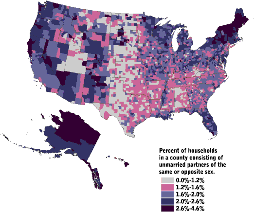
A statistical map is one in which the variation in the quantity of a factor, such as percent of rainfall within different geographic areas, is displayed. The three main types of statistical maps are choropleth maps, proportional symbol maps, and dot maps. The map above is an example of a statistical choropleth map, since it uses colors to show standardized data in the form of percents of household in a county consisting of unmarried partners of the same or opposite sex.
No comments:
Post a Comment